This is without doubt the snowiest winter in recent memory. Yet the snow we’ve received thus far hasn’t been more than a few inches each time, so while it’s enough to slow things down in the DC-Baltimore region, it’s not sizeable by any stretch.
This time, we’re expecting anywhere between 6 and 14 inches from Winter Storm Titan, depending on who you ask. For us in the Annapolis area, it’s expected to be closer to the upper end of that estimate.
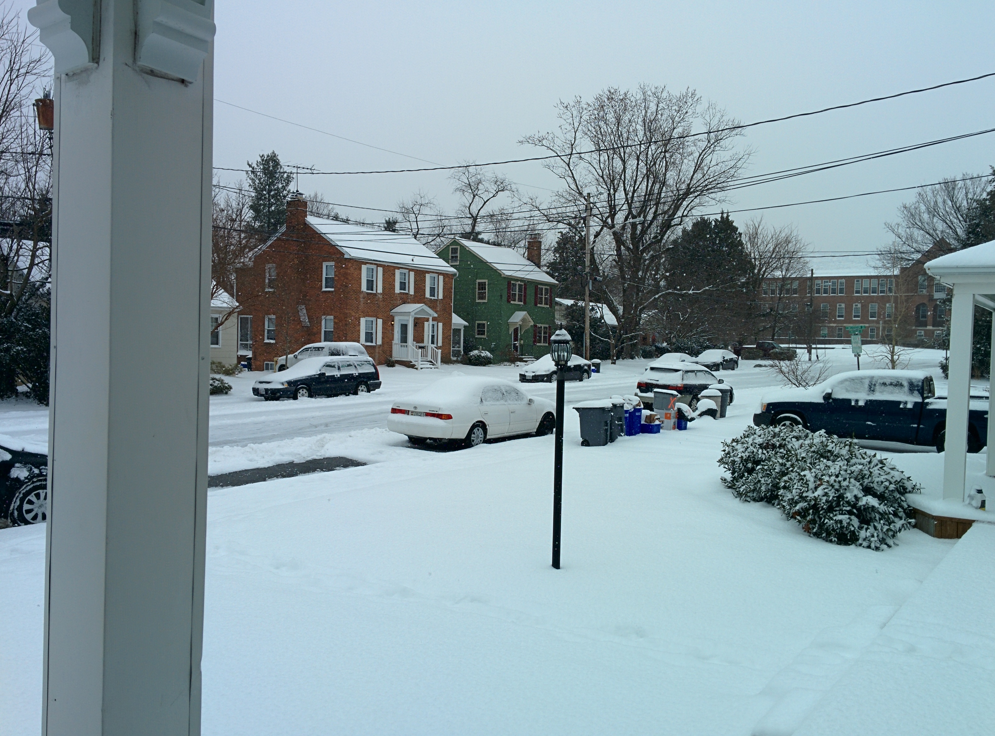
Annapolis is expecting its first significant snow of the year today, with a forecasted 6-10” of accumulation. As usual, I’ll be putting up pictures and videos throughout the day.
Liveblog January 21, 2014 12:26pm The start of the snow, just before noon.
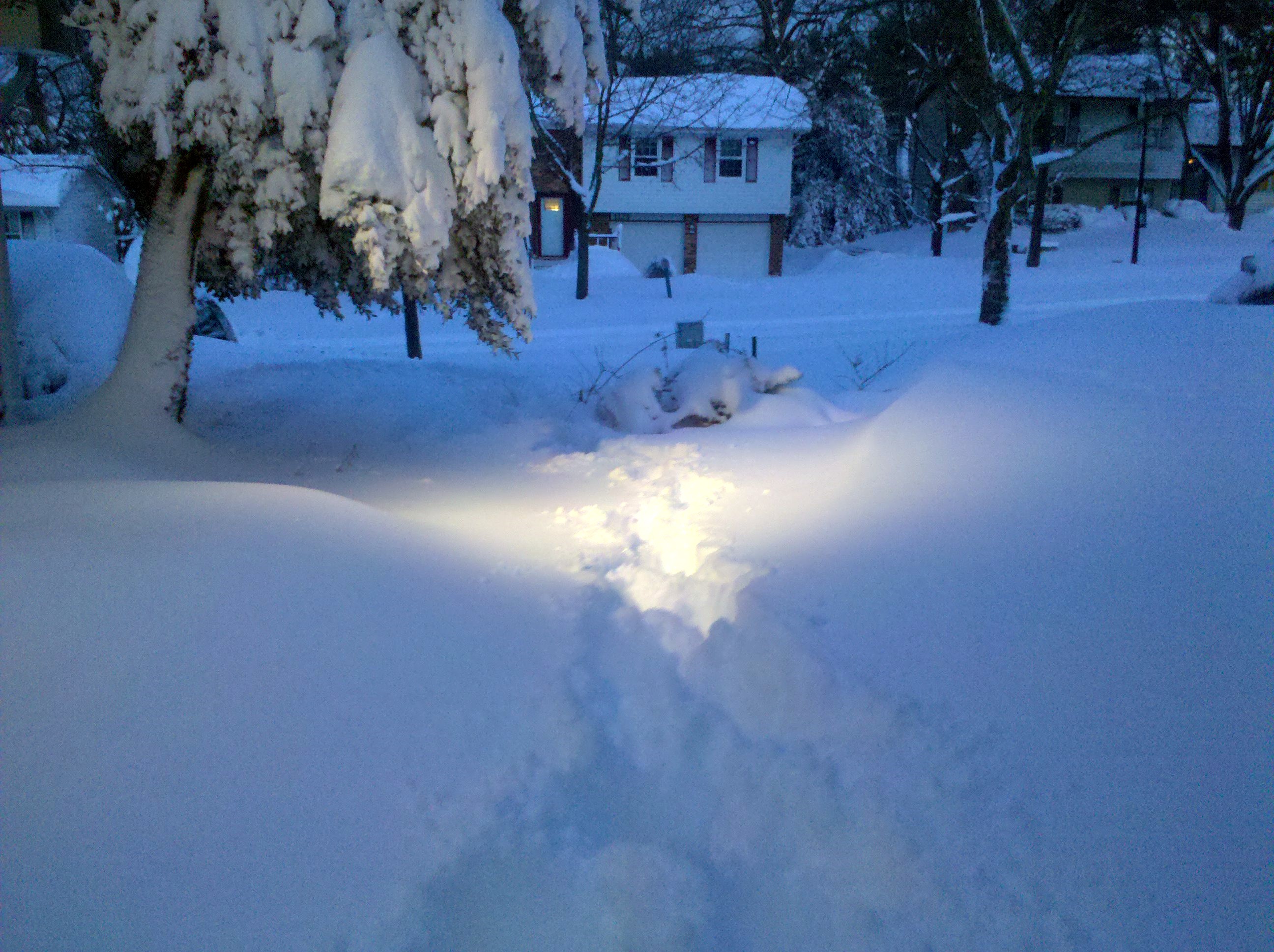
I set up a time lapse camera in my living room to capture the accumulation. I’ll have footage from that up later tonight or tomorrow morning.
January 21, 2014 12:50pm The snowfall has picked up, and so has the wind.
Well folks, it’s happened. Congress failed to pass a continuing resolution to fund the federal government, and as of this morning the government has shut down, all non-essential employees are at home, and essential and non-essential employees alike are without pay.
If you’re a government employee deemed “essential” then the good news is you’ll receive back pay for the time you work during the shutdown once the government resumes operations.
The Washington, DC area is expecting some snow over the next 24-36 hours, and while accumulations won’t be significant (less than 12 inches), it’s likely to cause some disruptions. BGE is pre-positioning assets in preparation for power outages, and local emergency management agencies are setting up shelters and posting preparedness reminders. Annapolis & Anne Arundel County aren’t likely to see more than a few inches so the impact should be minimal, but it’s best to be ready nonetheless.
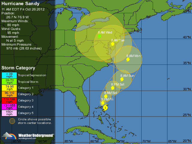
The Mid Atlantic region is getting ready for this season’s hurricane: Sandy. As of Friday morning (26 October, 2012) the storm is projected to make landfall on the east coast of the United States somewhere between the Chesapeake Bay and Long Island. Meteorologists are also suggesting that Sandy may combine with a nor’easter currently developing to create a much more powerful hybrid storm. Extensive damage, power outages and flooding are expected, with high winds, hurricane-force gusts and torrential rainfall that could last as much as a couple of days.
My father and I are headed up to Maine this weekend to close up our summer house. October is a great time of year to be there, since the leaves are changing and the weather is cool, but not so cold that it isn’t fun. I’ll be posting pictures on this page while we’re there, so check back for that.
11 October 2011, 0950 EDT So obviously the live blogging thing from Maine didn’t work out so well.
Hurricane Irene is coming. It’s gotten lots of coverage, and by the time it reaches my area it’s expected to be a Category 2, transitioning to a Category 1. While Annapolis isn’t on the direct path for the storm, we’re close enough that they’re projecting up to a foot of rain and a storm surge up to 4 feet high, which has the potential to do a lot of damage.